
Projects
PROJECTS & DEMONSTRATIONS
Explore our mapping, modelling, and measurement capabilities
At MÒR MAPPING, every project is driven by our commitment to Curiosity, Adaptability, Safety, Impact, and Quality (CASIQ) — the foundation behind each map, model, and mission. This page showcases the types of aerial intelligence we deliver across a range of environments and industries. Whether you’re assessing terrain, managing assets, planning development, or monitoring change over time, our drone‑derived datasets provide the clarity and accuracy needed for confident decision‑making.
Featured Example: High‑fidelity 3D models for visualisation, measurement, and design integration.
Every MÒR MAPPING project begins with a complimentary consultation, giving clients space to outline current challenges, upcoming milestones, and any areas needing closer inspection before any agreement is made. This upfront clarity
ensures each operation is tailored to the project’s needs and that every capture is purposeful, measurable, and aligned with the client’s objectives.
Once operations begin, flights are scheduled weekly or monthly depending on construction pace. Each visit follows a strict RTK workflow, building a continuous digital record of the site. This progress‑mapping approach regularly prevents
costly errors. In one case, a routine update revealed a concrete section 200 mm out of alignment; the centimetre‑accurate orthomosaic allowed the client to identify and correct the issue immediately, avoiding major rework.
Throughout the full construction lifecycle of this project, I returned to site regularly to build a continuous digital record — textured 3D meshes for design teams, dense point clouds for engineers, and full‑site digital twins that
could be measured down to the centimetre.
Revisit an Earlier Stage of the Build
Click the cube below to view the earlier stage
the MÒR MAPPING Experience
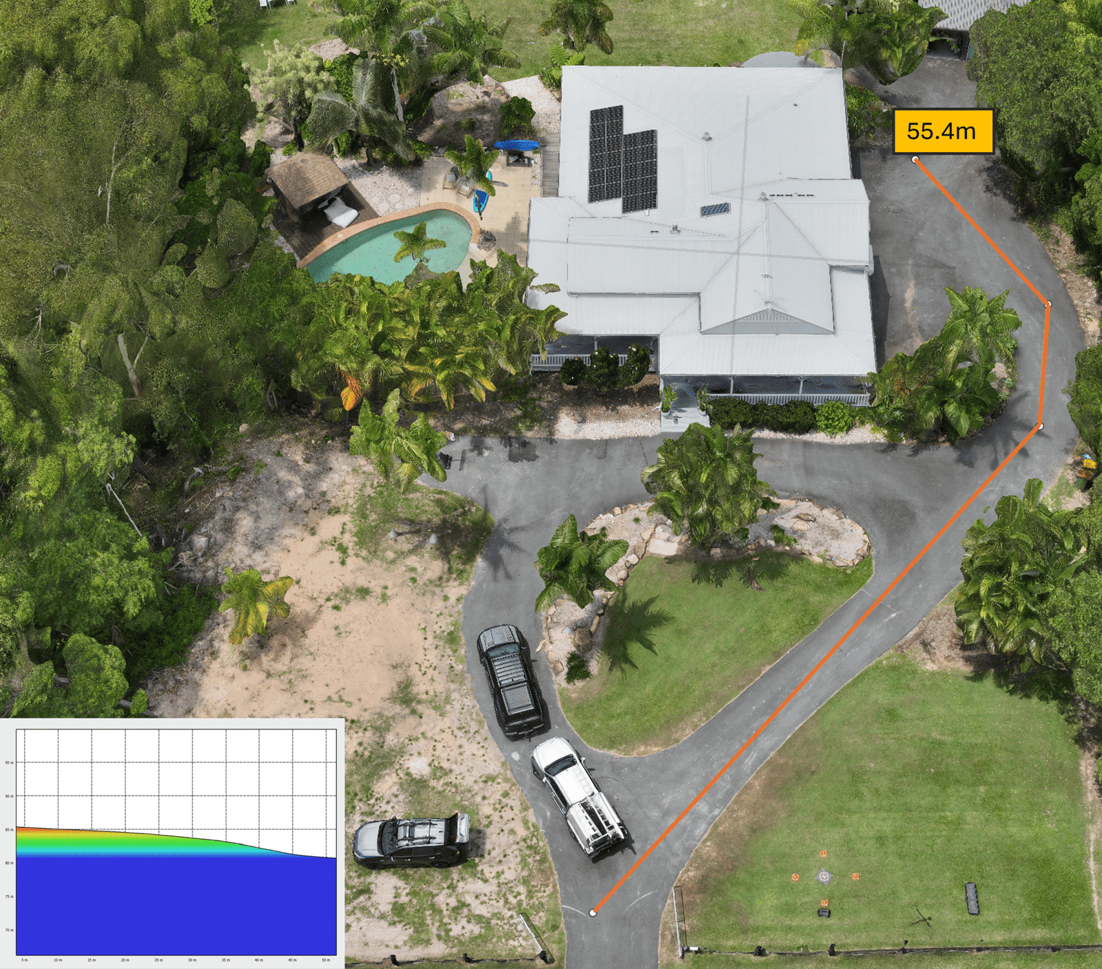
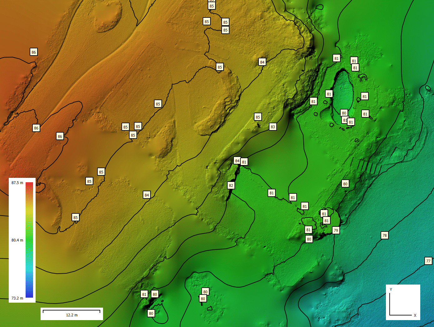
Survey‑Grade RTK‑Aligned Mesh
The MÒR MAPPING team operates under five core values — CASIQ: Curiosity, Adabtability, Safety, Integrity, and Quality. These principles guide every stage of planning, capture, processing, and communication, ensuring defensible, consistent, survey‑aligned outputs.
As you can see, our RTK‑aligned model provides measurement accuracy down to 1 cm. In this example, we’re able to pinpoint the exact moment the ground transitions into a slope — a critical detail for driveway compliance, drainage planning, and safe vehicle access. This workflow saved the client significant time and cost by allowing every new measurement to be taken remotely from their office. No travel, no delays, and no guesswork. Every detail of the site is already on their screen, ready to measure at any moment.