

Construction site mapping – south east queensland
The 200 mm that paid for itself
On a live build, a routine MÒR Mapping progress flight caught a concrete section sitting 200 mm out of alignment. Because the orthomosaic was survey-accurate, the client identified and corrected it on the spot — before it became major, expensive rework.
That’s what centimetre-grade aerial data does on a construction site: it turns a small problem caught early into a cheap fix, instead of an expensive one found late. Traditional walk-arounds miss it; a defensible, repeatable aerial record doesn’t.
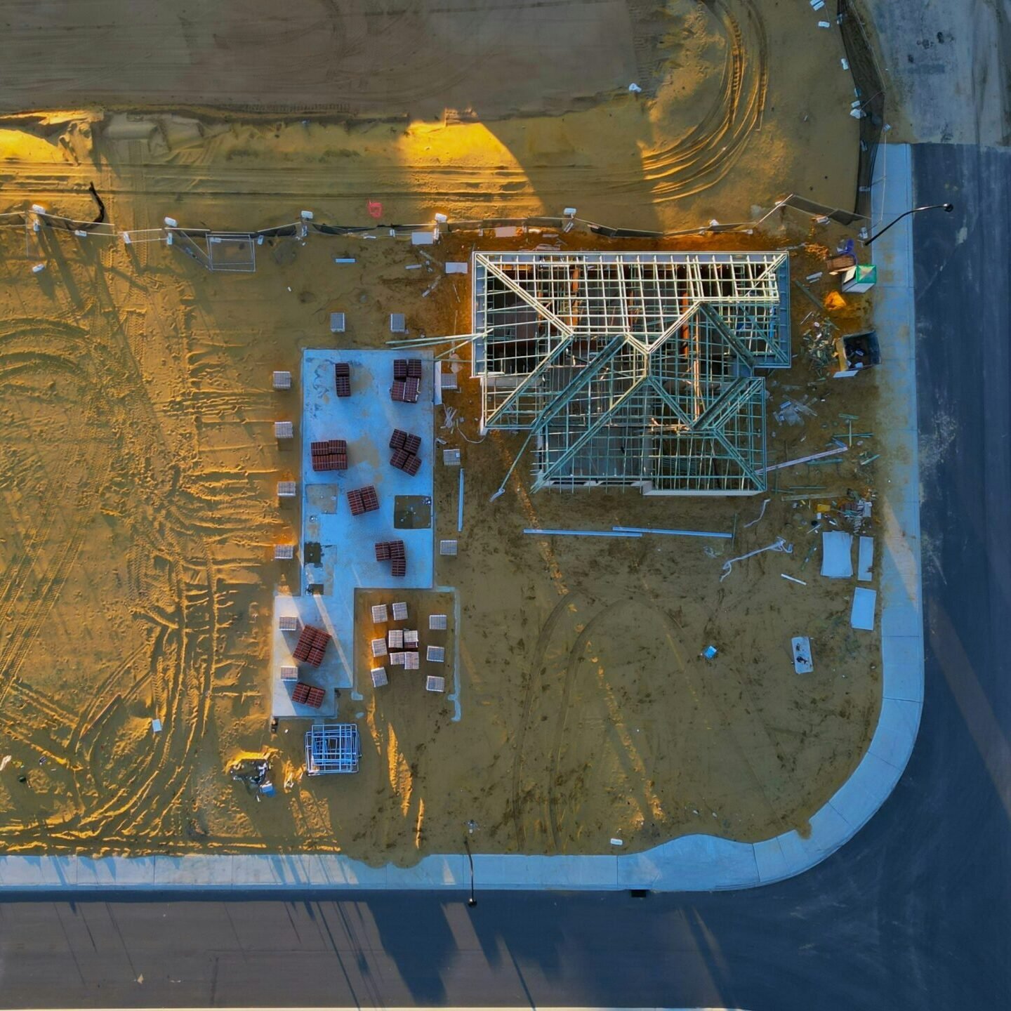
Aerial snapshot of active construction — roof framing underway, with scattered materials and site access/restriction points revealing the pace and complexity of early-stage works.
Drone imagery like this offers more than just elevation data: it captures real-world conditions, site logistics, and spatial context that ground teams can use to coordinate, inspect, and plan.
Spotting surface issues like cracks or access bottlenecks early can prevent costly delays. Regular aerial revisits build a visual timeline of progress to help project managers stay ahead of delays and ensure safety zones are respected — ideal for reporting, compliance, and stakeholder transparency.
Keep projects on track with aerial visibility and spatial accuracy.
Construction sites evolve fast — and so should your data. MÒR Mapping provides drone-based RGB imagery with GNSS and RTK precision to monitor progress, validate earthworks, and support compliance.
We deliver orthomosaics, 3D surface models, and change detection layers that help builders, engineers, and project managers stay aligned and informed.
For site managers and project teams, early detection of surface cracks, erosion, or access issues can prevent costly delays. Repeatable flyovers allow for weekly or fortnightly progress tracking, giving teams a visual record of work completed, materials moved, and site changes over time.
Whether you’re validating cut-fill volumes, monitoring safety zones, or preparing stakeholder reports, drone mapping offers scalable visibility and actionable insights — all with centimetre-grade accuracy.
What You Receive
- Site-wide orthomosaics and 3D surface models
- Progress and cut-and-fill analysis
- Stockpile volumes and terrain modelling
- Pre-construction baselines
- Change-detection layers between visits
- Branded progress reports for stakeholders
From residential developments to large-scale infrastructure, we help you see the site from above — clearly, accurately, and on schedule.
Continuous Site Visit Workflow
Every site visit begins with a complimentary consultation, giving clients space to outline current challenges, upcoming milestones, and any areas needing closer inspection before any agreement is made. This upfront clarity ensures each operation is tailored to the project’s needs and that every capture is purposeful, measurable, and aligned with the client’s objectives.
Once operations begin, flights are scheduled to your build pace — typically weekly or fortnightly — each following a strict RTK workflow that builds a continuous digital record of the site. As the 200 mm alignment catch above shows, this progress-mapping approach regularly prevents costly errors long before they turn into expensive rework.
Turnaround built around your program
Your data comes back as fast as your project needs it. Urgent captures can be processed within 12 hours; standard jobs are usually delivered within two to three days. Each update arrives as a full package — textured 3D meshes, survey-grade point clouds and lightweight viewer-ready files — organised and ready to open in CloudCompare, QGIS or your engineering software.
How we keep the data accurate
Accuracy is a workflow, not a slogan. We capture with survey ground control and PPK (post-processed kinematic) correction, and georeference every deliverable to GDA2020, MGA Zone 56 — the correct datum and zone for South East Queensland — so your data lines up cleanly with your coordinate system the first time.
MÒR Mapping operates under CASA Remote Operator’s Certificate (ReOC) 9785, with $20 million public liability and $5 million professional indemnity cover. We capture survey-grade supporting data; we’re not a registered surveying practice and don’t perform cadastral determinations, so where that’s needed we supply the aerial data that supports your surveyor’s work.
How We Work
Everything we do is guided by our five core values — Curiosity, Adaptability, Safety, Impact, and Quality (CASIQ). They shape how we plan, capture, process, and communicate, so every dataset you receive is defensible, consistent, and aligned with survey expectations.
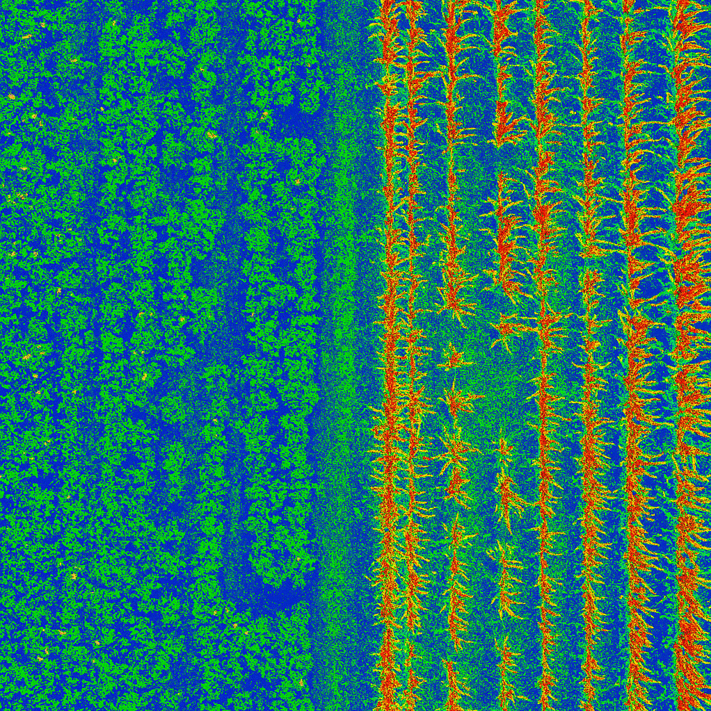
NDVI of active crop rows — The contrast in canopy density, leaf colour, and row structure offers valuable insight into crop health, growth stage, and field management.
Drone imagery like this supports precision agriculture by revealing subtle variations in vegetation, soil exposure, and harvest readiness. For growers and agronomists, these visuals help optimise inputs, monitor seasonal change, and plan interventions with confidence.
In agriculture, timely insights are everything. From crop health to irrigation planning, MÒR Mapping delivers high-resolution RGB imagery with GNSS and RTK accuracy — giving growers a full-field view of what’s working and what’s not.
We capture centimetre-accurate data across paddocks, orchards, and mixed terrain — producing orthomosaics, NDVI overlays, and 3D terrain models that turn raw drone imagery into actionable insights. With MÒR Mapping, you move beyond manual inspections and guesswork. Our quantifiable data gives you visual proof of what’s happening on the ground, helping you make confident, informed decisions.
What We Deliver
- Crop health & vegetation analysis
- Drainage & terrain modelling
- Repeatable flyovers for seasonal tracking
- Fast turnaround from capture to insights
Whether you’re managing 5 acres or 5,000, our drone workflows help you optimise inputs, reduce waste, and plan with confidence.
Not every project fits the mould — and that’s where MÒR Mapping excels. Whether you’re mapping heritage sites, environmental zones, or remote terrain, we tailor our drone workflows to your specific needs.
Using high-resolution RGB cameras, GNSS positioning, and RTK correction, we capture and process spatial data that’s accurate, repeatable, and ready for integration into your GIS or planning tools.
- Custom flight plans & deliverables
- 3D terrain & surface modelling
- GIS-ready outputs
- Portable offline mapping kits available
If it’s complex, remote, or unconventional — we’ll help you map it.
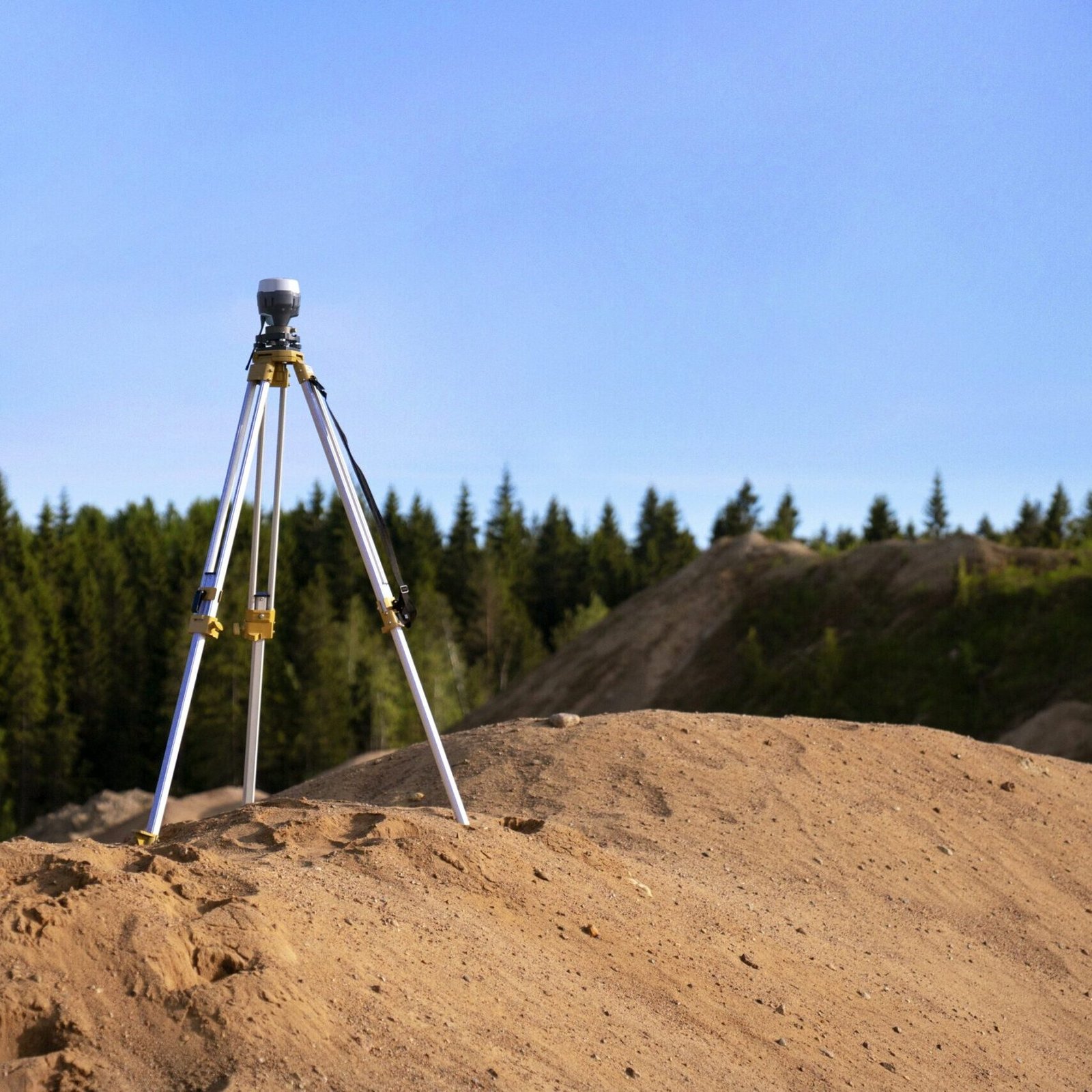
Safeguard operations with scalable, high-precision aerial mapping.
In mining, structural shifts can trigger serious consequences — from safety incidents to costly delays. Yet traditional monitoring methods often fall short in coverage, speed, and frequency. That’s where MÒR Mapping steps in.
We deploy drones equipped with high-resolution RGB cameras, GNSS positioning, and RTK correction to capture centimetre-accurate data across entire excavation zones — including areas that are hazardous or inaccessible by foot
What we deliver
- Orthomosaics & 3D Models for surface condition analysis
- Convergence & Change Detection across full excavation zones
- Repeatable Flyovers for time-series monitoring
- Rapid Turnaround from capture to analysis-ready outputs
Why Traditional Methods Fall Short
- Damage mapping is manual and prone to error
- Extensometers measure only isolated points
- Fixed sensors offer precision but limited coverage
Our drone workflows offer scalable visibility, faster insights, and repeatable results — helping mining operators meet safety and compliance standards while protecting profitability.
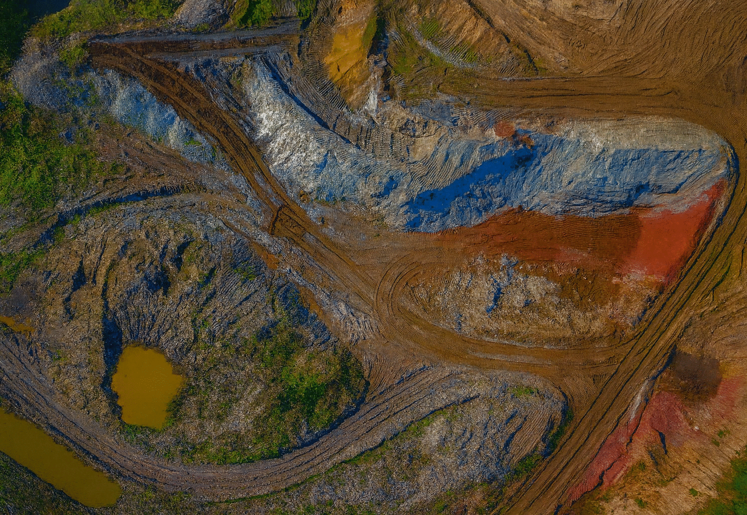
Topographic model from drone data — revealing elevation change detection, terrain profiling, and site access routes captured in centimetre-accurate detail.
This aerial dataset combines high-resolution RGB imagery with mechanical shutter precision and RTK georeferencing. The rapid 0.5-second interval shooting enables seamless coverage of excavation zones, while smart multi-angle capture supports volumetric analysis and elevation modelling – helping teams monitor change, confirm stability, and plan with confidence.
Frequently Asked Questions
How accurate is site mapping?
With RTK capture, survey ground control and PPK correction, we deliver centimetre-grade accuracy georeferenced to GDA2020 Zone 56 — reliable for progress monitoring, cut-and-fill and volumetric work on civil and development sites.
How quickly do I get the data?
Urgent captures can be processed within 12 hours; standard jobs are usually delivered within two to three days, as textured 3D meshes, point clouds and viewer-ready files.
How often should we fly a construction site?
Most clients schedule weekly or fortnightly flights matched to build pace, which builds a continuous digital record and catches issues like alignment drift or volume discrepancies early.
What formats do you deliver?
Orthomosaics, 3D surface models, point clouds and change-detection layers, ready for CloudCompare, QGIS or your engineering software. We confirm exact deliverables before we fly.
Do you cover all of South East Queensland?
Yes — we’re Sunshine Coast-based and work across South East Queensland, including Brisbane, Moreton Bay and the Gold Coast.
Are you CASA-certified and insured?
Yes. MÒR Mapping operates under CASA ReOC 9785 with $20 million public liability and $5 million professional indemnity cover.