Projects
Explore our mapping, modelling, and measurement capabilities
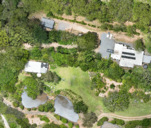
At MÒR MAPPING, every project is driven by our commitment to Curiosity, Adaptability, Safety, Impact, and Quality (CASIQ) — the foundation behind each map, model, and mission. This page showcases the types of aerial intelligence we deliver across a range of environments and industries. Whether you’re assessing terrain, managing assets, planning development, or monitoring change over time, our drone‑derived datasets provide the clarity and accuracy needed for confident decision‑making. Our aerial project management workflow supports a wide range of construction projects, from residential builds to large‑scale developments.
Every MÒR MAPPING project begins with a complimentary consultation, giving clients space to outline current challenges, upcoming milestones, and any areas needing closer inspection before any agreement is made. This upfront clarity
ensures each operation is tailored to the project’s needs and that every capture is purposeful, measurable, and aligned with the client’s objectives.
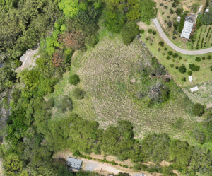
Once operations begin, flights are scheduled weekly or monthly depending on construction pace. Each visit follows a strict RTK workflow, building a continuous digital record of the site. This progress‑mapping approach regularly prevents
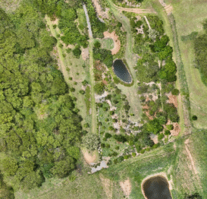
costly errors. In one case, a routine update revealed a concrete section 200 mm out of alignment; the centimetre‑accurate orthomosaic allowed the client to identify and correct the issue immediately, avoiding major rework.
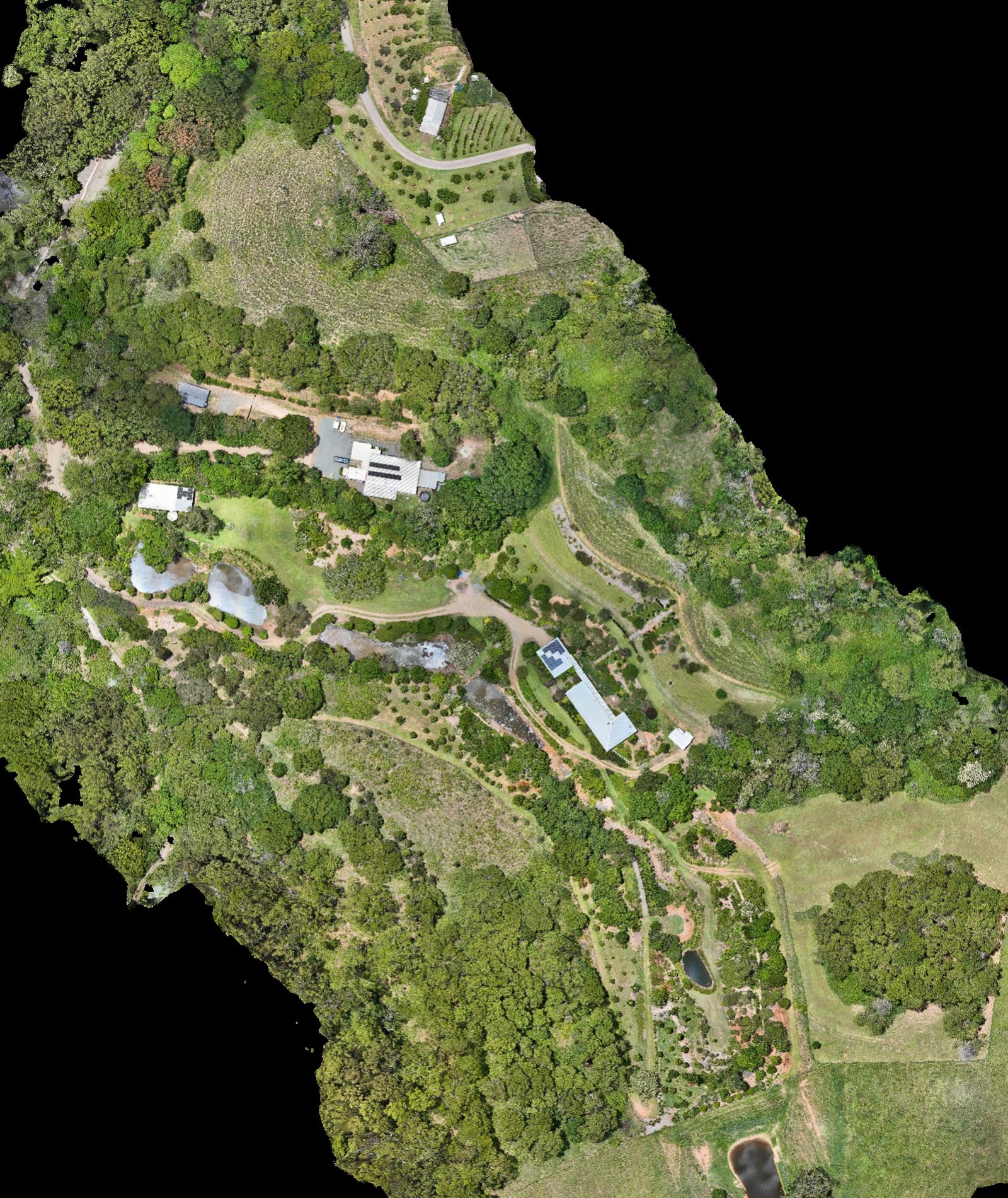
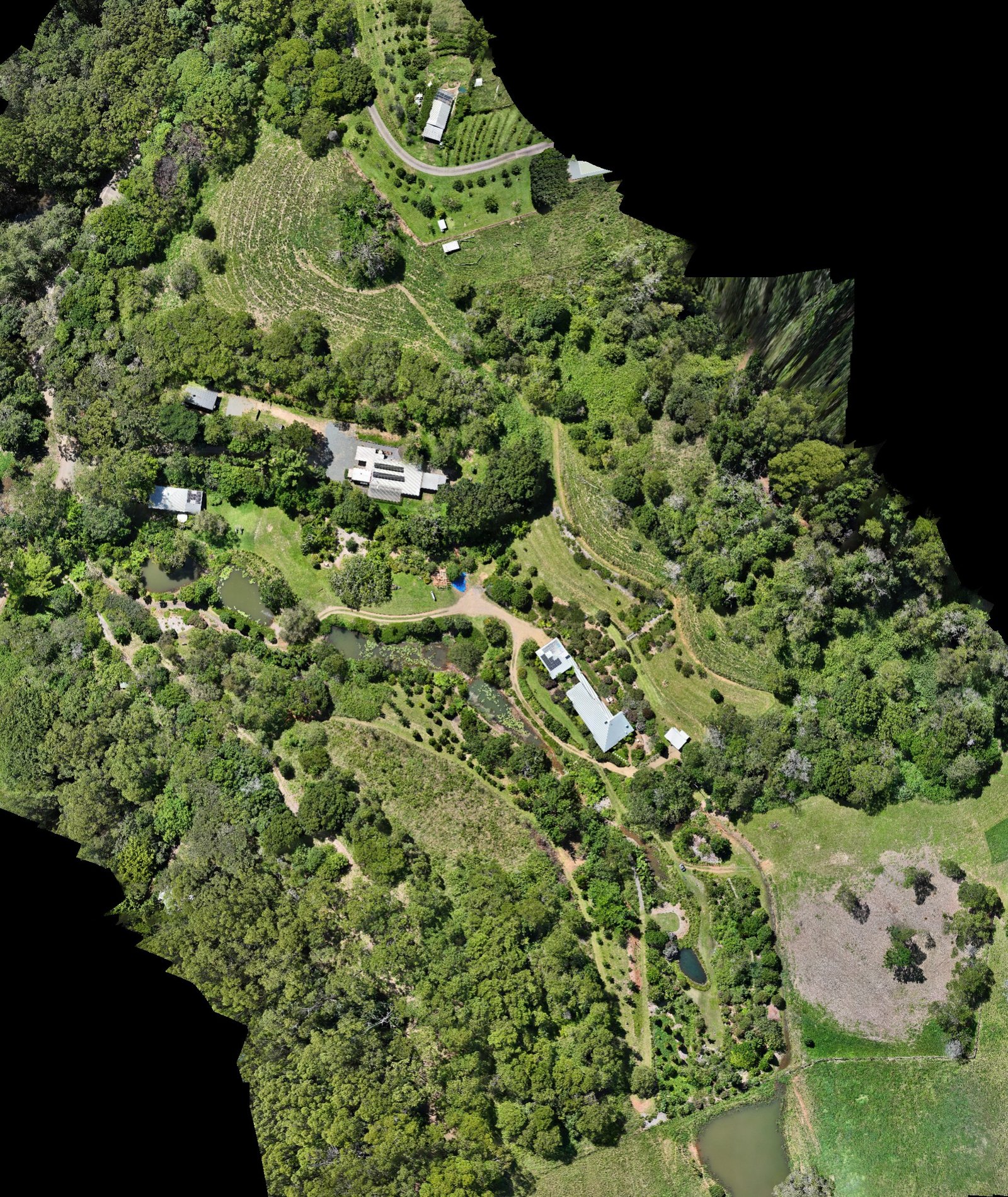
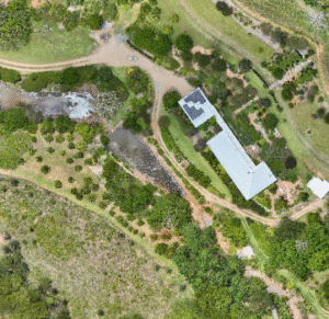
Throughout the full construction lifecycle of this project, I returned to site regularly to build a continuous digital record — textured 3D meshes for design teams, dense point clouds for engineers, and full‑site digital twins that
could be measured down to the centimetre.
How MÒR MAPPING Captures and Processes Your Site
Click the cube below to view the earlier stage (may not be suitable for phone)
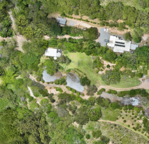
Aerial Project Management Across the Sunshine Coast
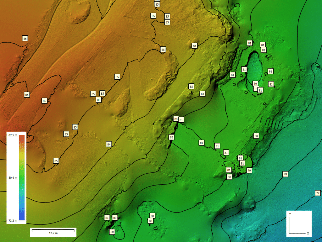
Survey‑Grade RTK‑Aligned Mesh
The MÒR MAPPING team operates under five core values — CASIQ: Curiosity, Adabtability, Safety, Integrity, and Quality. These principles guide every stage of planning, capture, processing, and communication, ensuring defensible, consistent, survey‑aligned outputs.
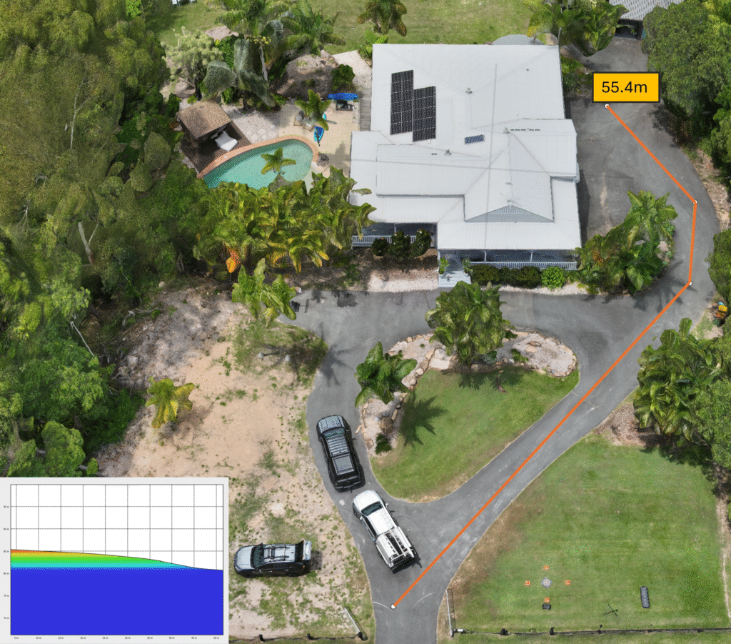
As you can see, our RTK‑aligned model provides measurement accuracy down to 1 cm. In this example, we’re able to pinpoint the exact moment the ground transitions into a slope — a critical detail for driveway compliance, drainage planning, and safe vehicle access. This workflow saved the client significant time and cost by allowing every new measurement to be taken remotely from their office. No travel, no delays, and no guesswork. Every detail of the site is already on their screen, ready to measure at any moment.
Aerial Project Management & Drone Mapping Capabilities
Aerial project management brings clarity, accuracy, and real‑time visibility to construction, development, and land‑based projects. By combining drone mapping, high‑resolution photography, and 3D modelling, MÒR MAPPING delivers a complete visual record of your site at every stage. This approach gives project managers, builders, engineers, and stakeholders the information they need to make confident decisions without relying on assumptions or outdated data.
At its core, aerial project management is about reducing uncertainty. According to the Queensland Government’s development and planning guidelines, accurate site documentation supports better project oversight and more efficient decision‑making.
Traditional site inspections can only capture a small slice of what’s happening on the ground. With drone‑based data, you see the entire site from above, from the side, and in full 3D. This means you can track progress, identify issues early, and verify work against plans with measurable accuracy. Every deliverable is created with survey‑grade precision, ensuring your team is working from reliable, defensible information.
MÒR MAPPING’s workflow is designed for projects that demand consistency and technical clarity. Each capture is planned, flown, and processed using a repeatable method that ensures every dataset aligns with the previous one. This allows you to compare stages over time, monitor changes, and maintain a complete visual history of your project. Whether you’re managing a construction site, a rural property, or a large‑scale development, aerial project management gives you a level of oversight that simply isn’t possible from the ground.
Our deliverables are built to be practical and easy to use. Orthomosaics provide a high‑resolution, true‑to‑scale map of your site. DEMs reveal elevation changes, drainage patterns, and earthworks progress. Dense point clouds and 3D models allow you to measure distances, heights, volumes, and areas with confidence. These outputs integrate seamlessly with tools like QGIS and CloudCompare, giving your team the ability to analyse and measure without needing specialised software or training.
Aerial project management also improves communication across your team. Instead of relying on written descriptions or phone calls, you can share clear, visual data that everyone understands instantly. This reduces misinterpretation, speeds up decision‑making, and keeps all stakeholders aligned. For clients, it provides transparency. For contractors, it provides accountability. For managers, it provides control.
MÒR MAPPING works closely with builders, surveyors, engineers, and property owners across the Sunshine Coast to deliver reliable, repeatable aerial data. Every project is approached with precision, consistency, and a focus on producing clean, professional outputs that stand up to scrutiny. Our goal is to give you the tools to manage your project with confidence, backed by accurate information and clear visual documentation.
Aerial project management is not just about capturing images from above — it’s about creating a structured, measurable dataset that supports better planning, reporting, and decision‑making. Whether you need regular progress captures, pre‑construction documentation, or a one‑off site model, MÒR MAPPING provides a tailored solution that fits your workflow.
If you’re looking to improve visibility, reduce risk, and streamline communication across your project, aerial project management is one of the most effective tools available. With accurate data, clear visuals, and a consistent capture method, you can stay ahead of issues, verify work, and maintain full oversight from start to finish.
To discuss your project or schedule a capture, get in touch with MÒR MAPPING. We provide reliable, high‑quality aerial data that helps you manage your site with clarity and confidence.