Volume measurement without guesswork
Stockpile, earthworks and quarry volumes from drone mapping, with the base, the method and the accuracy measured at independent checkpoints stated on every report.
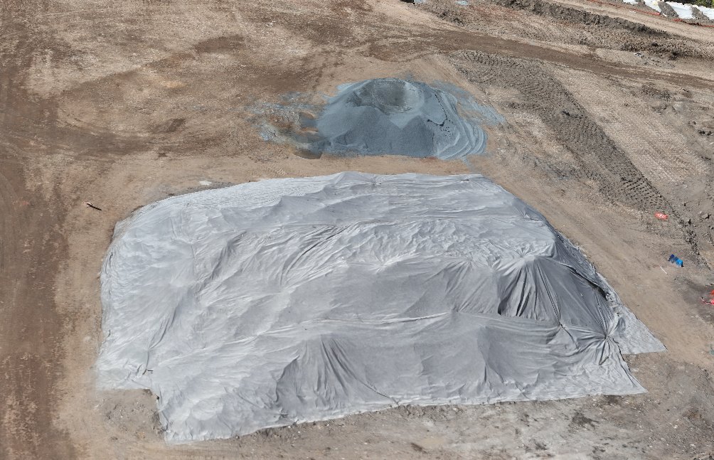
Covered stockpile: 557 m³, footprint 368 m², max height 3.00 m
What is volumetric measurement?
A drone captures the whole surface of a stockpile, pit or earthworks area in one flight. We build an elevation model from the photos and measure the space between that surface and a base: the ground under a stockpile, your design levels, or an earlier capture of the same site.
Because every point of the surface is measured, not just a handful of spot heights, the volume follows the real shape of the material.
- Stockpiles
- Quarries and pits
- Cut & fill
- Bulk earthworks
- Material tracking between captures
How we calculate volumes
The same steps on every job, so a volume this month can be compared with the next.
- Drone capture
A planned flight on an RTK workflow, with ground control and independent checkpoints measured on the ground.
- Photogrammetry processing
The photos are aligned and tied to the control points to build the site in real-world coordinates.
- Surface model
An elevation model of the current surface, checked against the independent checkpoints.
- Reference surface
The base the volume is measured from: the ground at the toe, your design surface or an earlier capture. The report says which.
- Volume calculation
The difference between the two surfaces, worked out by software across the whole area, as cut, fill and net volume.
- Client reporting
Volumes with the base, the method and the measured checkpoint accuracy, plus maps your team can read at a glance.
Volumes between two captures depend on how well the captures agree with each other. How we report accuracy →
Deliverables
Stockpile and area volumes, each with its base, method and footprint.
Cut, fill and net volumes against your design or an earlier capture, with a heat map of where they are.
Contours from the surface model for design and earthworks checks.
Surface (DSM) and bare-earth (DTM) elevation models for your engineering software.
Repeat flights on the same control show what moved between visits and how much.
Textured 3D models of the site to explore, measure and share.
Why use drones?
Ground-based measurement picks up spot heights where a person can walk. A drone captures the whole surface from above.
A stockpile yard or earthworks area is usually captured in a single flight.
Nobody needs to climb stockpiles or walk the face of a pit.
Every part of the surface is captured, including areas that are hard to reach.
The same flight plan and control can be flown each visit, so captures can be compared.
Plant and trucks can keep working while we fly, subject to the site's safety rules.
Every report states the accuracy measured at independent checkpoints. If something wasn't checked, it says so.
Our mapping is for planning, measuring and monitoring. For cadastral or boundary surveys and set-out, we're happy to work alongside your registered surveyor.
Where it's used
Stockpiles and pit progress.
Product stockpiles and extraction between captures.
Earthworks against design and material on site.
Cut and fill on roads, pads and drainage.
Bulk earthworks across stages.
Material stockpiles and landform change.
Example deliverables
From a real earthworks progress report. Each volume is measured from the surface model to a base at the stockpile's toe.